![]()
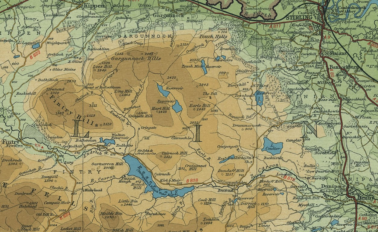
Map A
A map from the 1940's showing the position of the parish of St Ninians and the Carron valley to the SW of Stirling. The largest reservoir marks the line of the now flooded river.
Several of the Adam farms lie along the river valley running from Fintry in the west towards Denny in the east. Others are situated along the lower, eastern slopes of the Gargunnock Hills from Dundaff Hill northwards to the River Forth.
Map B
Two maps covering in more detail the two regions of St Ninians which feature most of the Adam farms.
For these two maps, each of the larger intervals on the border measures approximately one km.
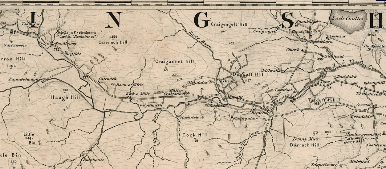
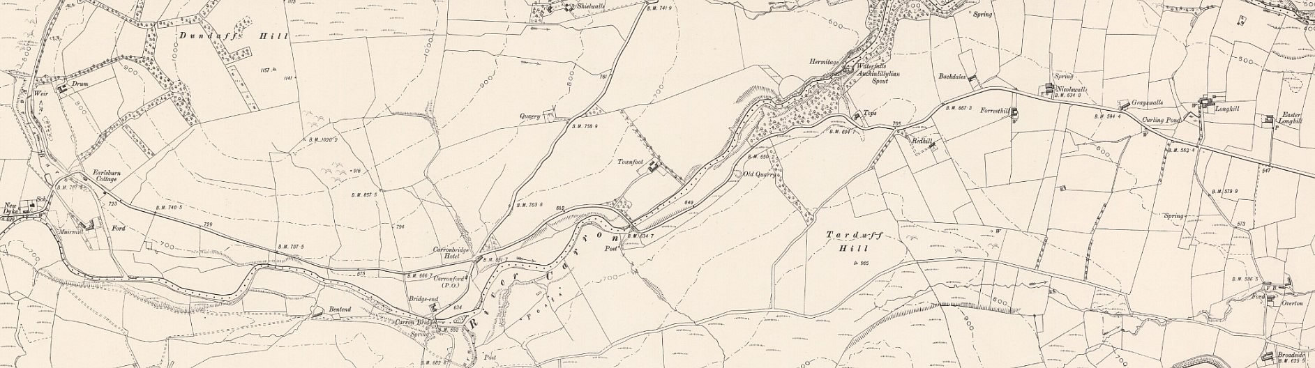
The Upper Carron valley showing several of the farms which feature in the Adam family through the censuses from 1841 to 1901.
From west to east along the river: Cairnoch, Craigannet, Easter Craigannet, Glendales and Muirmill.
Kirkburn is the unnamed farm across the road from Kirk O' Muir.
Easterton is the unnamed farm midway between Easter Craigannet and Glendales.
Overton is south of the river close to the eastern edge of the map.
Buckieburn and Craigengelt are north of the Carron near Loch Coulter.
![]()
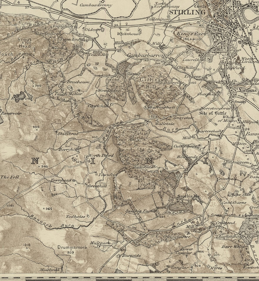
Map C
There are a few Adam farms further north of the Carron valley.
Starting from the southern edge of the map are:
Muirhead, Muirpark, Todholes, Greathill and North Third.
At the northern edge, just outside Stirling lies North Kirsebonny.
Several names are repeated across the region and one in particular merits mention. Todholes appears in the NW corner of Map B and also close to the Bannock Burn on Map C.
It is the latter farm which was run by members of the Adam family as may be confirmed by noting that the other Todholes is in the parish of Fintry, not St Ninians.
Two further enlarged map views that show additional names and also help to locate some farms that are not named on any maps.
Map D
Some farm names do not seem to be mentioned on any maps but their approximate locations may be deduced by tracing the likely route of the census enumerator.
Bridgeland States is one of these problem places. In the 1841 census it is listed between Bridgend and Earl’s Burn Cottage on one side, and Carron-ford on the other. This sites it somewhere along the western half of the Carron valley shown on this map.
Harden is also difficult to find, however it is named on the same page as Bridgend for the 1851 census and so it is likely to be in the same general area of the valley.
Over on the eastern end of the map are Nicholswalls, Grayswalls and Overton.
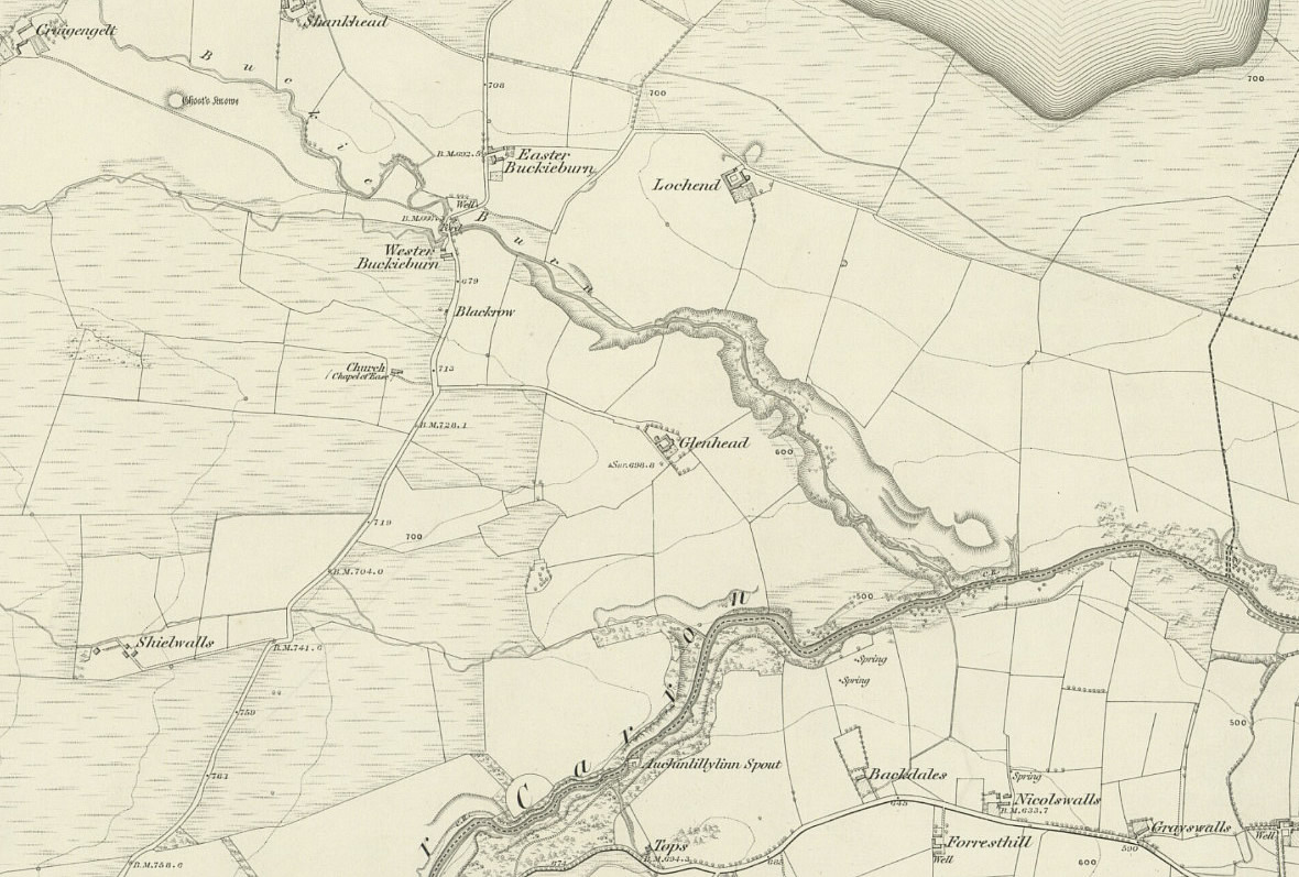
Map E
On this map the two Buckieburn farms, Easter and Wester, are clearly shown either side of the Buckie Burn.
It was Easter Buckieburn that was often shortened to just Buckieburn on the censuses.
Also named are Craigengelt in the NW corner of the map and Nicholswalls and Grayswalls in the SE. These were all farmed by members of the Adam family or their in-laws from time to time.